Northwest Arkansas is known for its biking and hiking trails, many of which are located in Bella Vista. The trails in Bella Vista were designed and constructed primarily for mountain biking, as Northwest Arkansas has become a mountain biking hot spot known by mountain biking enthusiasts around the nation.
Use of the trails for hiking is also permitted. With numerous elevation changes due to the Ozark Mountains, you can find various levels of challenging trails. Bella Vista also offers paved walking trails at Lake Bella Vista, Loch Lomond, and Branchwood. The trails are free to use, and you do not need to be a P.O.A. member to enjoy all that the trail have to offer. Here’s a look at the Bella Vista trail system.
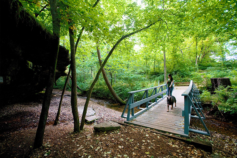
Blowing Springs Trail

Blowing Springs Biking Trails offer 6.3 miles of natural-surface trails at Blowing Springs Park in Bella Vista, which may also be suitable for hiking. The rolling contour trails range from two to three feet wide. The trails are designed and constructed to be used by mountain bikers of all age and skill levels, although use of the trails for hiking is permitted. The trails have been designed to take advantage of the park’s natural beauty, including its many bluff lines, springs, caverns and established natural habitat. One of the trails’ highlights is a 30-foot bridge that leaves a rock shelf to connect to the trail below that winds around to a “natural air-conditioned cavern,” which releases 60 degree air. The trail system includes a total of eight bridges and 15 benches. Given the terrain, some of the trails are inherently more challenging; however, the trail was built with safety and sustainability in mind.
Directions (from Town Center on Arkansas 340/Lancashire Boulevard): Take U.S. 71 south. Turn left on Dartmoor Road.
Branchwood Nature Trail

The 1.5 mile paved walking and biking trail winds through the natural rolling hills of the Ozark with scenic bridges and benches.
Directions (from Town Center on Arkansas 340/Lancashire Boulevard): Take Arkansas 340 west. Go through the Highlands Gate. Turn right on Glasgow Road. Travel 3.8 miles. The trail is on the right.
Loch Lomond Walking Trail

The nearly 3,300-foot walking trail sits on the community’s west side. The level trail, which is located below the Loch Lomond Dam, has a paved surface and available parking. The trail loops around a softball field.
Directions (from Town Center on Arkansas 340/Lancashire Boulevard): Take Arkansas 340 west. Go through the Highlands Gate. Turn right on Glasgow Road. Travel about one mile. The trail is on the left.
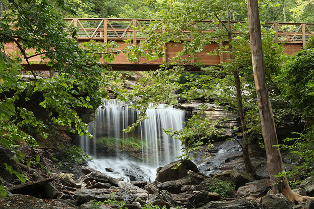
Tanyard Creek Nature Trail
Tanyard Creek Nature Trail, which was constructed by volunteers, is a two-part trail with parking. The first part of the paved walking trail is a relatively level 0.3-mile loop through open country. Meanwhile, the other portion of the trail is moderately hilly. The trail stretches through woods and along Tanyard and Sunshine creeks. This portion of the trail has a well-maintained natural surface. In addition, the 2-mile trail connects to the top of the Lake Windsor Dam, which takes hikers past a breathtaking waterfall. This section adds another half of a mile of level, paved walking. The total length of the trail is about two miles. Both portions have signs describing the plants and flowers hikers will see along the way. The Tanyard Creek Pavilion sits at the trail’s entrance.
Directions (from Town Center on Arkansas 340/Lancashire Boulevard): Take Arkansas 340 west. The trail, which is less than a mile from Town Center, is on the left.
The Back 40 Trail System
The Back 40 is a 40 mile soft mountain biking trail system that is located on the east side of Bella Vista and is open to the public. This trail was designed and constructed primarily for mountain biking, but using the Back 40 to hike is permitted. Additional information about The Back 40 Trail System can be found at www.bellavistaar.gov.
Trail Heads
Buckingham Trailhead — Trafalgar Road and Buckingham Drive
From U.S. 71 northbound: Right (east) on Trafalgar Road for 1.2 miles, left on Buckingham Drive. The trailhead is on the right.
Lake Ann Trailhead — Castleford Drive and Wem Lane
From U.S. 71 northbound: Right (east) on Trafalgar Road for 3.8 miles, left on Castleford Drive. The trailhead is on the left after one-quarter mile.
Bear Hollow Trailhead — Gainford Drive and Gosforth Lane
From U.S. 71 northbound: Right (east) off exit 98 (Lancashire Blvd.) for 3.2 miles, left on Gainsford Drive. The trailhead is on the left after 350 feet.
Trails
Beginner trails:
Mulligan (.93 miles)
Intermediate trails:
The Back 40 Loop (21.4 miles)
Brittany Dam (.17 miles)
Buckingham Cutoff (.08 miles)
Flo Ride (2.17 miles)
Merritt Spur (.1 miles)
Pinyon Creek (2.08 miles)
Rago (2.96 miles)
SBAT (2.33 miles)
Taylor Homestead (1.71 miles)
Tower Trail (.11 miles)
Expert/Advanced trails:
The Ledges (2.94 miles)
Lookout (.35 miles)
Summit School (.5 miles)
What the Chuck (.1 miles)
*Bella Vista trail information provided by www.bellavistapoa.com and www.bellavistaar.gov.
**For a complete list of all Northwest Arkansas trails visit Oz Trails at www.oztrailsnwa.com.